Welcome to the Historic Columbus Indiana Website!

Downtown Columbus Indiana: Redevelopment Area (Homes)


Home Page

About The Historic Columbus Indiana Website

Bartholomew County Directory 1903 -- 1904

Bill Stearman

Columbus Indiana: A Day In The Life...

Columbus Indiana: Downtown Pictures 1966

Columbus Indiana Fire Department

Columbus Indiana Picture Collections

Columbus Indiana Historic Postcards

Columbus High School Yearbooks and Logs 1916 --1970

Cummins Bookstore History

Crump Theatre History

Historic Columbus Indiana Site Map

I Discover Columbus, by Will Marsh

Illustrated Columbus Indiana 1914 -- 1915

John Crump: Columbus Indiana Pioneer

Links to other Columbus Indiana-related sites

MESSAGE BOARD!

Old Historic Columbus Indiana Website

Schwartzkopf Opera House

What Columbus Indiana Watched on Television

Write to me


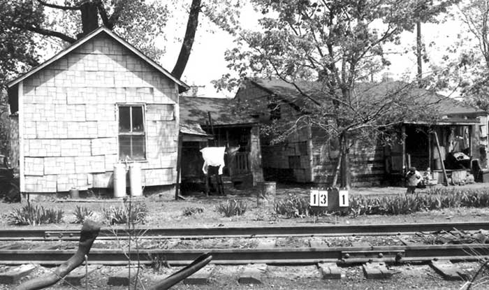
The above map depicts the street layout of downtown Columbus in the mid-1960's. You will notice that Jackson Street is not blocked off by the Commons Mall. It once was used as a major artery feeding through the city, but it looked much different than it does now. Railroad tracks ran along Jackson, somewhere between 5th Street and 13th Street, and somewhere just past 11th Street, toward the west of Jackson Street, was the switching yard.


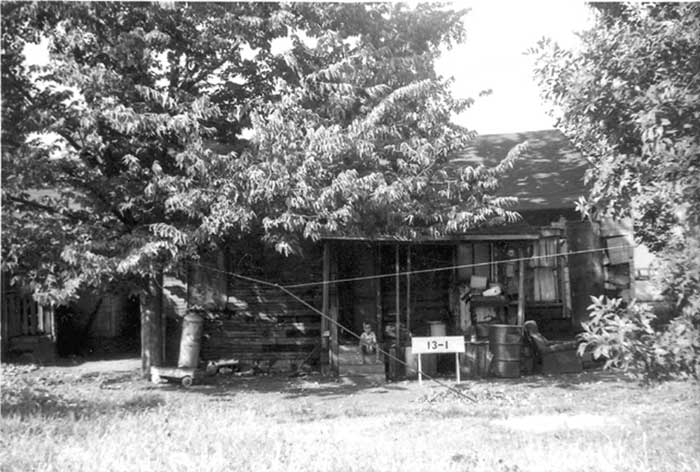
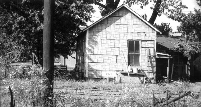
     For those of you who did not grow up in Columbus, but moved here after the mid-1970's, it would be hard for you to imagine what the downtown area used to look like. Beginning in the early 1960's, an effort was made to "clean up" the downtown area. The first beginnings of this was Death Valley. Many are curious about this part of Columbus, for good reason. The living conditions in Death Valley were a small step away from what we now call homeless. People did have shelter, if you want to call it that. Infestations of rats and floods only added to the existing problems the people of Death Valley had to endure, not to mention how they were viewed and treated by the people of Columbus. It wasn't an uncommon sight to see men with burlap sacks, walking along the tracks which straddled Jackson Street, searching for coal that might have fallen off train cars, to heat their dwellings.

     I have a feeling that Death Valley existed for quite some time, dating as far back as the late 1800's. In one of the news shorts on the Columbus Indiana: A Day In The Life web page, mention is made of a family camping along the banks of the White River, just off 4th Street. It is very possible that this type of lifestyle was the beginnings of Death Valley.


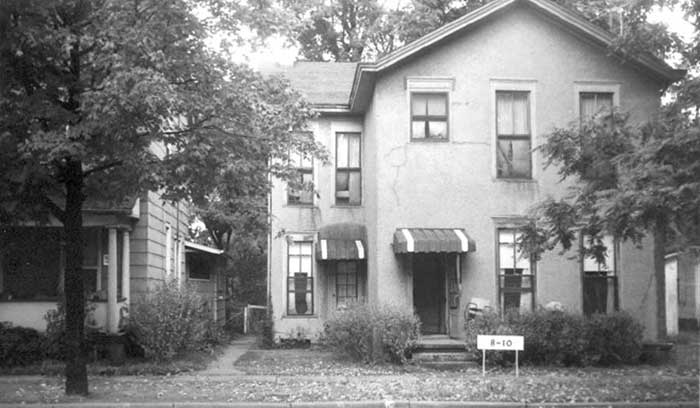
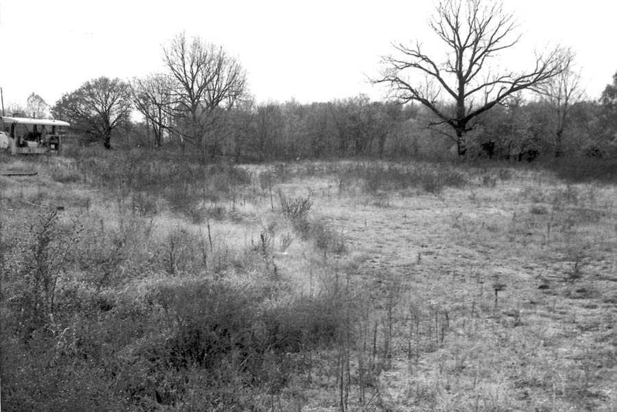
     Death Valley wasn't the only area targeted for redevelopment by the city. Many houses and businesses once lined the areas where the post office is, as well as the entire area due south. First, Second, Third, Fourth, Lindsay, Jackson, and Brown Streets held homes and neighborhoods where people lived and worked.


     If you've visited the Columbus Indiana: Downtown Pictures 1966 web page, you've certainly got a taste of what Columbus looked like back in the 1960's. But, that's only a small picture of the whole.


     Offered here are some other pictures of the homes from the area at that point in time. You can reference, in general, where the homes were located by referring to the above map. The "100 block addresses" would have begun at Lindsay Street, running east (or, from left to right in the above picture). Even addresses were on the left hand side of the street if traveling east (north side), and odd numbered addresses on the right side (south side).


     If I had to pick one picture from this part of Columbus' past that captures the feelings some of the residents had regarding the "new" downtown changes, this is the one. With his truck loaded, and two small daughters in hand, this young man looks out his front door, and I wonder what his thoughts were. Also, if I had to pick one picture of what life was like growing up on Center Street in the 1960's, this captures life as it was in some parts of my old neighborhood...


106 4th Street


     Located right beside the railroad tracks, this home's address was 29 4th Street. A typical, small, shotgun style home that wasn't an uncommon sight in the downtown area in the 1960's....


29 4th Street


      A similar style home to the one above...


133 4th Street


     This picture of the back of 133 4th Street gives the viewer an idea how close the homes were to one another...


133 4th Street Rear View


     The back side of 213 4th Street...


213 4th Street Rear View


     This picture of an outhouse was given an address of 39 4th Street...


39 4th Street


     An apartment house in the 100 block of 2nd Street...


111-113 2nd Street


     Sitting on the front porch of 121 2nd Street. I reported earlier that most of these pictures were taken in 1966. I now believe that I was off a couple of years, and believe that the majority of them were taken around 1968...


121 2nd Street


     A nice, two-story home at 128 2nd Street...


128 2nd Street


      This picture gives the viewer an overall look at almost half of the city block in the 100 block of 2nd Street, and includes Bob's TV Repair, the apartments listed above, and an auto repair place...


Parcel 10-4 2nd Street


     This little kid sitting on the back porch of his home at 209 1st Street in the mid to late 1960's...


209 1st Street


     This picture of the back of 201 1st Street shows just how close this home sat to the railroad tracks...


201 1st Street


     It should be noted that all of these pictures came from Gene Roberts. They were tossed out of City Hall into a dumpster, but Gene saved as many as he could find. When I received the box of photos from Richard Bray, some were attached to sheets of paper that listed the address of the house or business, and basic information regarding the property. Many photos, however, were loose. This picture is one of the loose ones, so the location of the property is unknown to me. The parcel, however, is identified as 13-1...


Location unknown


     I scanned many of the pictures from Gene's collection, then gave the box to Joy Deckard, who took the time to scan all of the pictures on this page. Joy apparently spoke with someone regarding the location of this photograph, and she lists it as being a block from the Post Office, but closer to 5th Street than 4th...


Location Unknown


     The City Water Works, circa 1968....


City Water Works


     The address on this home is 90, but the street is unknown. The parcel, however, is 3-5...


Location unknown


     The location of this property is not identified, but the Courthouse is visible in the background. I believe this property was located on Jackson Street, between 1st and 2nd...


Parcel 12-2


     Maybe More Pictures Will Follow